|
USDA Hardiness Zone Map Understanding how to use the hardiness map could be one of the most useful tools you have when determining what plants to use for your food plot or restoration project. Each section of the map has a corresponding color code that will give you the estimated annual low temperatures for that area. Throughout the catalog, you will notice that there is a zone specified for each product. 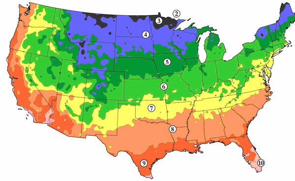 To choose plants that should have a better chance of success for you, reference your location on the map to determine your zone, and them make sure the plants you have in mind are suitable for that zone. There will be exceptions since natural fluctuations in growing conditions could vary from area to area. If you need more assistance, contact your local agricultural extension office for your specific zone. |